Vintage ad: Farm for sale

October 1851:

FARM FOR SALE – The farm belonging to Sam’l Berry, dec’d, on Pompton Plains, is offered for sale, in parts or whole, to suit the purchaser, situated on the main road from Newark to Pompton, also on the road leading to Paterson, and within ten minutes walk of the Church and Academy. For particulars enquire of PETER S. BERRY 157 Charles st, N.Y. or HUGH HEATH, 6 Columbia st Newark, or on the premises.

The “main road from Newark to Pompton” was, in fact, the Newark-Pompton Turnpike. “Within ten minutes walk of the Church and the [Union] Academy” tells us it wasn’t far from the First Reformed Church of Pompton Plains.  That’s all I know; perhaps some Berry descendant can add more in the Comments.
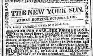
 

Ad - Berry farm for sale (1851)
Ad – Berry farm for sale (1851)

Greetings from Pequannock, N.J.

Your typical “greetings from” postcard shows a generic illustration of fields, a country road, a lake, or whatever. This one, at least, does appear to have been taken in Pequannock. It shows a lovely view of the river… with Newark’s four-foot water pipeline crossing it.

Postcard sent in 1922

An idyllic scene, ostensibly from Pompton Plains. It’s probably a generic card, as witness the blocky font with the town’s name. “Greetings from YOUR TOWN HERE”.


Postcard sent in 1928

Dawn’s Rest

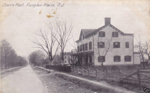
“Dawn’s Rest” was, in the early part of the 20th Century, one of many places that a weary traveler could put up his feet and relax for a spell. Back in the day, Pequannock — in fact, the whole of north Jersey — was tranquil and restful. It offered a respite from busy city life (by comparison).

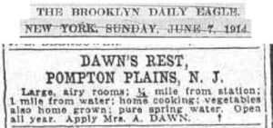
Dawn's Rest ad (1914)
Dawn’s Rest ad (1914)

Mrs. Dawn’s place offered “large, airy rooms” just a short walk from the railroad station. Naturally, all the meals were “home cooked”, including vegetables from a no doubt sizable garden out back. And it was open all year, guaranteed to be “an ideal winter home for settled people”.


Dawn’s Rest, Pompton Plains, looking south (early 1900s)


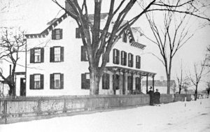
Dawn's Rest, looking north
Dawn’s Rest, Pompton Plains, looking north (early 1900s)


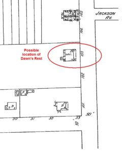
We have a pretty good idea where Dawn’s Rest was once situated: on the Turnpike, just south of Jackson Avenue.  This 1937 Sanborne map marks it as “vacant”.


Dawn's Rest location
Dawn’s Rest location


Today, there’s a strip mall at that location. It’s between the Little Food Inn and the Lutjen building.

So who was “Mrs. A. Dawn”?  I can’t seem to find her in either the Ancestry or FamilySearch genealogy databases. Maybe it was a pseudonym.

The Cleary building

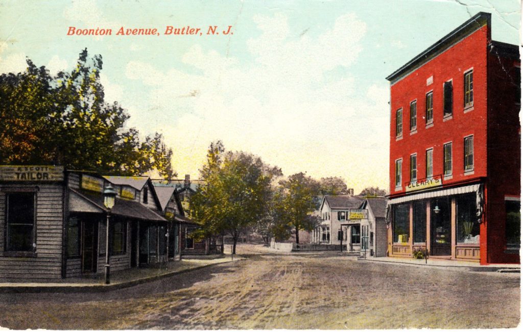
This building, on the corner of Boonton Ave. and Kiel Ave., started out as Cleary’s Department Store early in the 20th Century.  It also served as the town’s post office after the Clearys moved to a different location. Note the unpaved roads, which became quite messy in wet weather.

Just past it is Cleary’s Grocery Market.  Across the street is A. Scott, Tailor. Someone on the Butler page on Facebook commented that the tailor shop became Henry Ricker’s Pharmacy, while one of the next stores was King Hiller’s music store. Hiller also played the organ in the Butler Theatre, back in the day.

Click on this hand-colored postcard to see the full-sized version.


Cleary building
Boonton Ave & Cleary building, Butler, about 1907

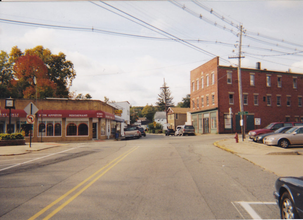
Here’s how it looked in 2001. (I strive to duplicate the old photos as closely as possible.)  It also looked pretty much the same in the early 1980s when I worked for Suburban Trends, which occupied all three floors. The printing press was in the garage next to it.

The buildings across from it are still there, still in use as storefronts. This 2000 photo shows the corner store was Cafe Buono; before that, when I worked in Butler, and for many years before and after that, it was Pro’s Sweet Shop. The locals still speak of it wistfully. It was a great luncheonette.

Cleary building (2000)
Boonton Ave & Cleary building (2000)

Lyon’s Butler Theatre

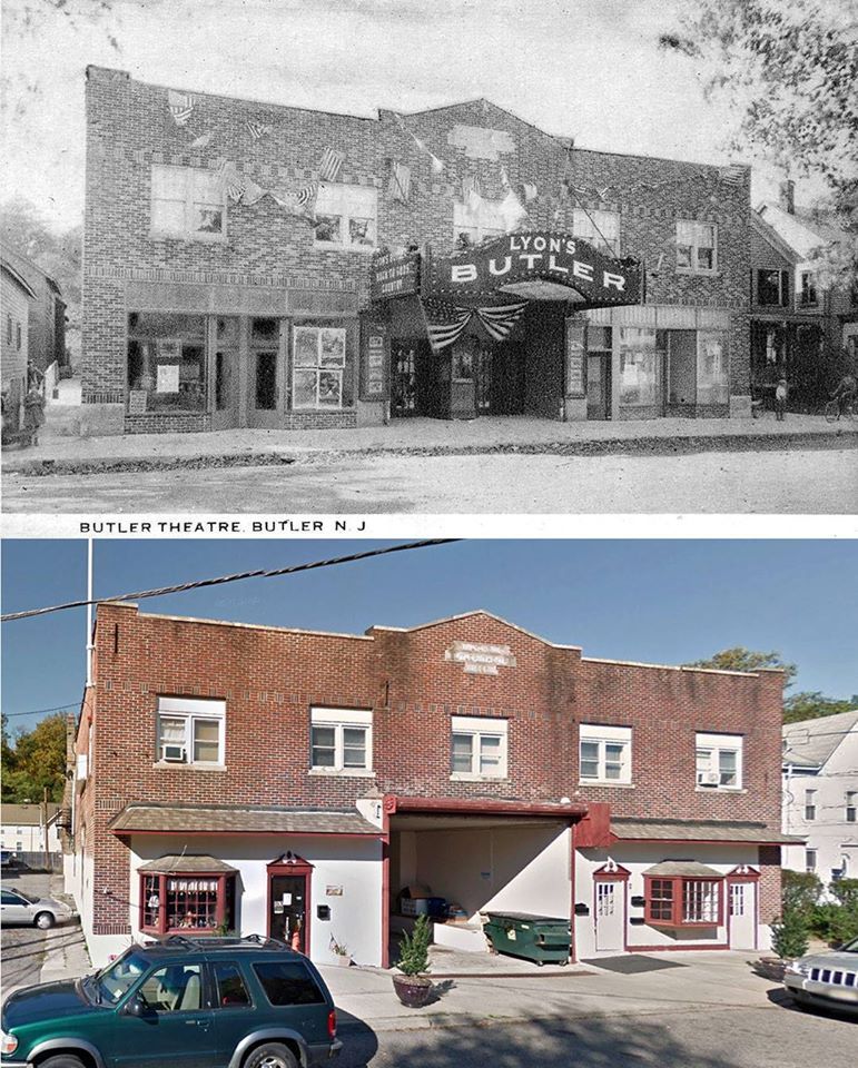
Lyon’s Theatre sits on lower Arch Street, near the Bloomingdale border. Most folk just called it Butler Theatre.  Can’t say I know much about this place, but I’m sure it was the place to be on a Friday night. I wonder what movies they showed?

According to the Facebook Butler page, King Hiller — who owned a music store on Kiel Ave, across from Cleary’s Department Store — played the organ during those silent films.  Evidently it closed sometime in the 1950s.


Butler Theatre then & now

Otto’s Deli

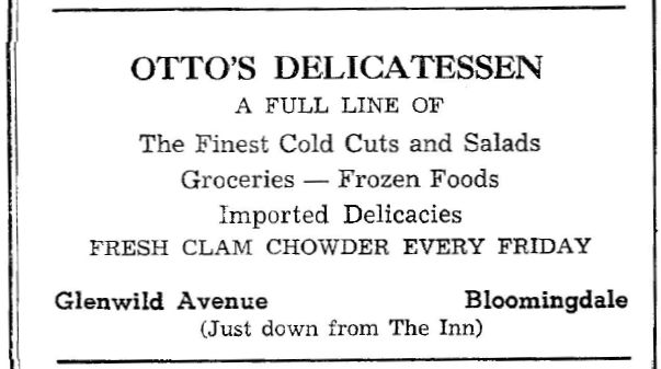
Otto’s Deli has been a landmark on Glenwild Ave. at Ann Street since the 1960s, as this advertisement will attest. Before that it was Hamburg Turnpike by Vreeland Ave.

The deli was still there, run by a fine fellow named Helmut. I’m told the potato salad is excellent. Have to try it one day when I’m in the neighborhood.

Where was “The Inn”, I wonder?  Share your thoughts in the comments.


Advertisement for Otto's Deli (1965)
Advertisement for Otto’s Deli (1965)


Otto's Deli today
Otto’s Deli (2017)

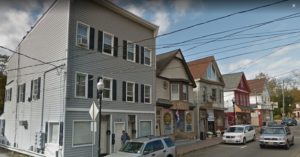
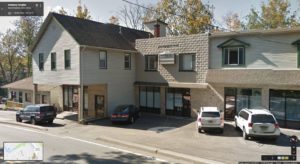
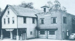
Bloomingdale’s Municipal Building, then & now

I’m not sure just how long this building served as Bloomingdale’s municipal HQ, but long after a new municipal building was constructed, this one is still in use — and largely unchanged from back then.

Bloomingdale Municipal Building site (2013)
Bloomingdale Municipal Building site (1940s)


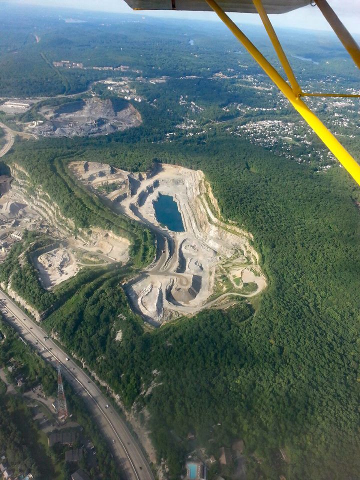
Federal Hill, seen from the sky

Federal Hill is well known to history buffs. It was used as a lookout by Washington’s troops during the Revolutionary War.  It bore witness to the infamous Pompton Mutiny.

Centuries later, it was the site of a German Bund camp during World War II; more on that later.

Since then, however, it’s been fodder for a quarry. Much of it has been devoured, and what’s left will disappear in time.

Aerial view, Federal Hill (Sept 2016)
Aerial view of Federal Hill, with I-287 running nearby.  (Sept 2016)